
Electronic Warfare Distorted Black-Headed Gull GPS Tracks
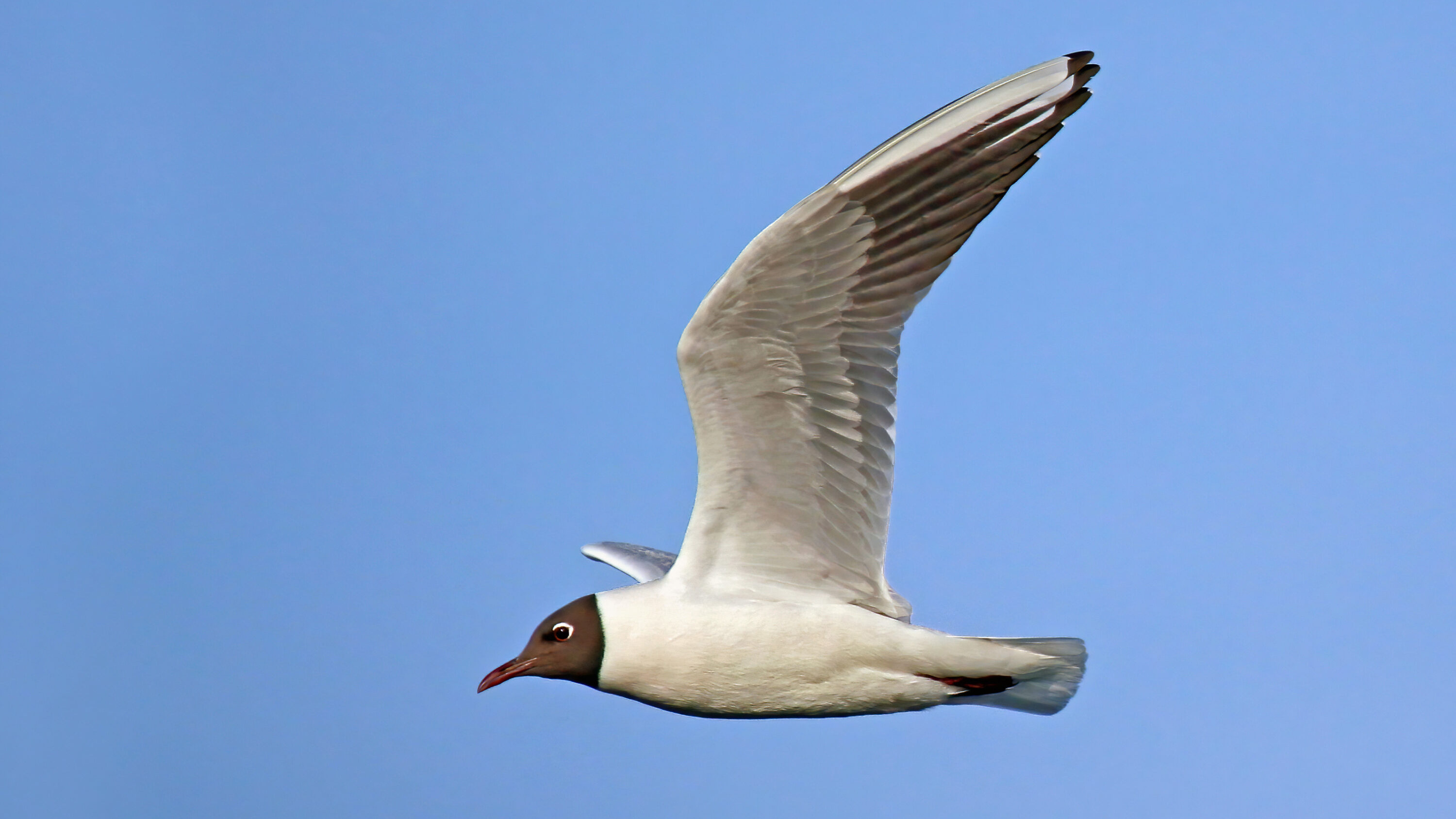
Electronic warfare in Eastern Europe is disrupting GPS data from black-headed gulls (Chroicocephalus ridibundus) migrating between Spain and breeding areas in Russia and Ukraine. An analysis published in Ambio on 13 April 2026 documented erratic, low-quality and geographically impossible positions in tracks recorded near conflict zones, with the problem becoming more pronounced in 2025.
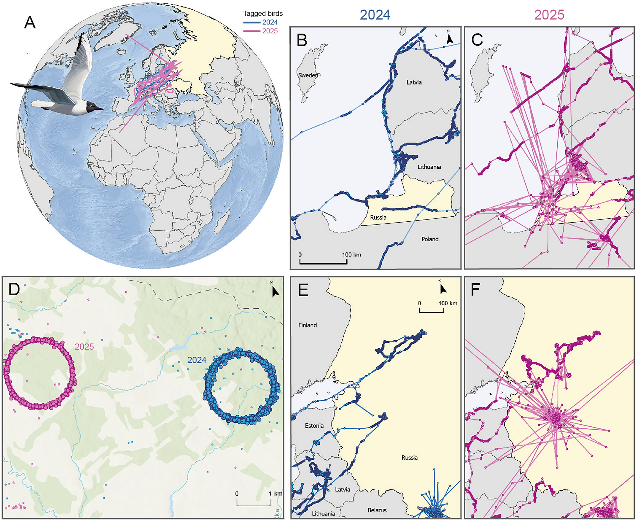
Some recorded positions were geographically impossible
The researchers examined trajectories from gulls tagged at their wintering site in Barcelona. In affected regions, the devices sometimes placed birds in Algeria or Greenland while their surrounding track remained in Eastern Europe. Other records formed near-perfect concentric circles or jumped back and forth over implausibly large distances. Low-precision and erratic positions were especially common around Kaliningrad and within Russia, and the anomalies increased in 2025.
Jamming and spoofing can corrupt wildlife tags
The patterns overlapped with areas known for electronic interference with global navigation satellite systems. Jamming floods navigation frequencies with noise so a receiver cannot calculate a reliable position. Spoofing instead supplies false signals that make the receiver report an incorrect location. The gull tags were civilian instruments that were nevertheless affected by the same GNSS interference.
A tracking point is not automatically a biological observation
Corrupted positions can be mistaken for unusual migration routes, stopovers or rapid long-distance movements and can also hide the places the birds actually used. This matters when tracking data are used to locate breeding colonies, migration corridors or other important habitats. It also affects One Health applications, which connect animal, environmental and human health: unreliable tracks make it harder to identify visits to landfills or wastewater-treatment plants that may be relevant to the spread of antibiotic-resistant bacteria, and can reduce the reliability of movement-based risk maps for highly pathogenic avian influenza such as H5N1.
The authors call for systematic identification, reporting and correction of geopolitical GNSS errors in tracking datasets. They also argue for methodological flexibility and continued use of independent, lower-tech marking and monitoring methods such as bird ringing, so that anomalous satellite positions are not mistaken for animal movements.
Other research
Related news

GPS-Based Models Highlighted the Lower Sumida as a Key Black-headed Gull Corridor in Tokyo
GPS tracking showed that black-headed gulls followed different river features at different movement scales in Tokyo, while GPS-based…
Read story →
Black-headed Gull Sample Yielded the Longest Known Calicivirus Genome
A Hungarian black-headed gull faecal sample yielded an 8,845-nucleotide avian calicivirus genome with unusual RNA structures and enough…
Read story →
New Papillomavirus Genome Identified in Black-headed Gull Faeces in China
Researchers identified the 7,794-base-pair CrPV1 genome in faecal samples from black-headed gulls in Sichuan and found it genetically…
Read story →SPECIES IN THIS STORY
Species in this story

Independent research and conservation news archive
Did you find this information useful?
Wildlife Vagabond is independently built and maintained. Voluntary support helps cover source verification, hosting and continued work on research and conservation news.
Support Wildlife VagabondThe news archive will remain freely available.