
Models Identified Potential Elephant Connectivity Areas Far Beyond Mozambique’s National Parks
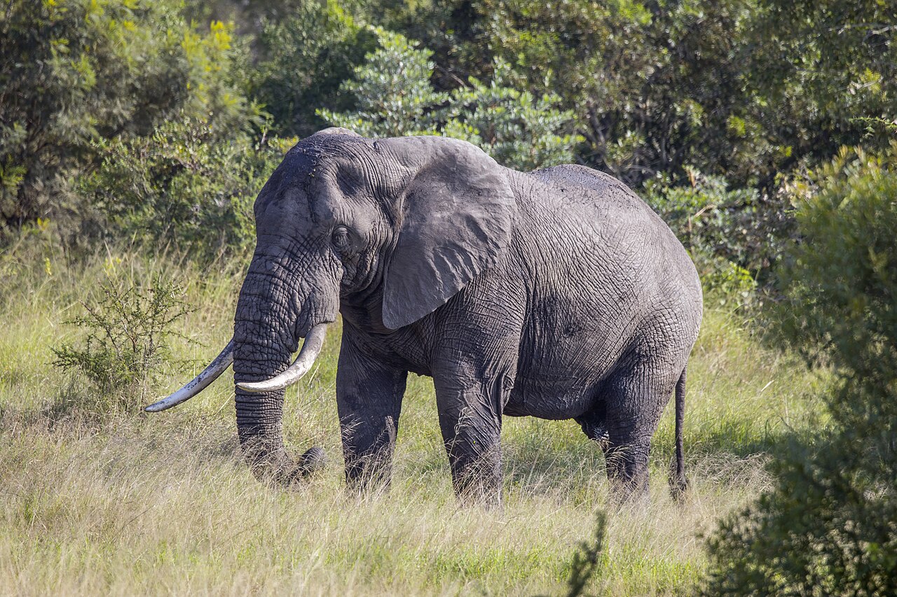
Connectivity models for African bush elephants (Loxodonta africana) in southern Mozambique identified potential movement areas that extend far beyond national-park boundaries and frequently cross landscapes used by people. The 2026 study combined GPS locations from elephants with models of habitat use and landscape connectivity across the Great Limpopo and Lubombo transfrontier conservation areas.
The analysis used 284,752 cleaned GPS positions from 27 elephants monitored between 2016 and 2025. The researchers first asked which landscape features were associated with where tracked elephants were found, and then used that relationship to model where the wider landscape could potentially support movement between major national parks.
GPS use was converted into a map of landscape permeability
The first step was a Resource Selection Function. This type of model compares locations used by tracked animals with the environmental conditions available across the landscape. A higher modelled probability of elephant use was then treated as lower resistance to movement — in practical terms, a part of the landscape through which elephants would be more likely to move than through less suitable surroundings.
Human modification was by far the strongest predictor in this habitat-use model. The Human Modification Index combines several forms of human pressure into one continuous measure, and accounted for about 72.1% of the standardized influence of the five predictors. Higher human modification was associated with lower elephant use. Distance to water was the next most influential factor at 12.9%: elephants were more likely to use areas closer to water. Greener vegetation, measured with NDVI, was also positively associated with use, while steeper terrain was used less.
Circuitscape mapped potential routes, not tracks followed by individual elephants
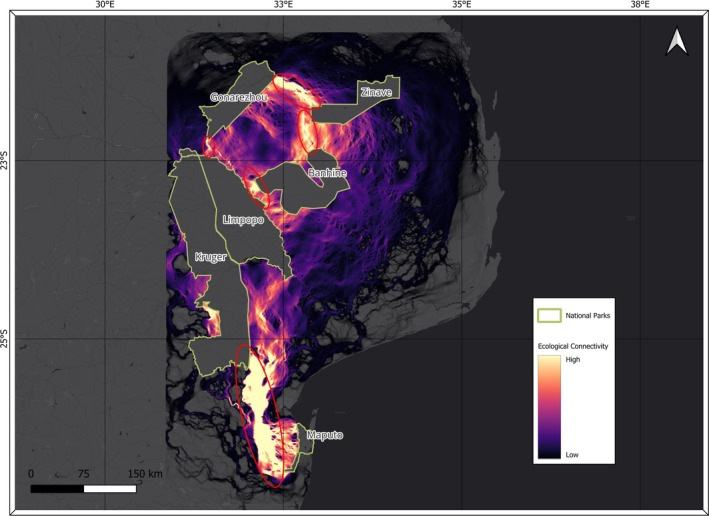
The researchers then used Circuitscape, a connectivity model based on circuit theory. Instead of drawing one best route, the model treats the landscape like an electrical network: areas with lower resistance carry more modelled “current”, so broad zones of high current indicate several possible ways animals could move between protected areas.
This is an important distinction from GPS tracking. The study explicitly aimed to map broad-scale potential ecological connectivity rather than reconstruct the actual path taken by each elephant. In the observed telemetry data from 2016–2025, direct movement between the focal Mozambican national parks was recorded only between Limpopo and Banhine, while substantial eastward movement also occurred into unprotected land.
Potential connections differed strongly between park pairs
The strongest northern result was a broad, continuous area of high modelled connectivity between Gonarezhou and Zinave national parks. Gonarezhou–Banhine connectivity was weaker and lacked a clearly continuous corridor, while the Banhine–Zinave connection was broad but more discontinuous.
Potential connectivity between Gonarezhou and Limpopo was minimal and narrowed to a small, discontinuous pinch point. By contrast, the model identified a clearer but localized potential connection between Limpopo and Banhine.
In the south, the Limpopo–Maputo pathway produced the highest connectivity values in the study, with a broad high-current band interrupted by one important bottleneck. Kruger National Park in South Africa had a central structural role in this modelled linkage; without Kruger as a conduit, potential connectivity between Limpopo and Maputo would be much weaker.
Human-used land is part of the connectivity network
Many of the modelled priority areas cross community land, peri-urban zones and other human-modified landscapes. This does not mean elephants prefer heavy development — the habitat model showed the opposite. It means that the remaining landscape connections between protected areas often have to pass through places where people live, farm and use natural resources.
The authors therefore argue that maintaining elephant connectivity cannot be achieved by protected areas alone. They recommend land-use planning that keeps critical bottlenecks permeable, stronger coordination across national borders and direct involvement of local communities in areas where potential elephant movement and human land use overlap.
The maps are best read as a planning tool showing where the landscape could support future elephant movement and genetic exchange. They are not evidence that every modelled corridor is currently used as a regular elephant route, and the authors call for further monitoring to test how elephants actually use these priority areas over time.
Habitat protection
Related news
An ancient viral gene may have been repurposed in elephant placenta
An ancient viral gene that appears to have been inherited for at least 79 million years is strongly…
Read story →
Three Ways of Analysing Elephant Calls Gave Different Results
Recordings from a semi-free herd in South Africa show how the method used to classify call timing can…
Read story →
African Bush Elephants Distinguished Artificial Food-Quantity Patterns at Close Range
In experiments in South Africa, four semi-tame elephants chose between visual patterns representing canopy size and leaf density.…
Read story →SPECIES IN THIS STORY
Species in this story
Independent research and conservation news archive
Did you find this information useful?
Wildlife Vagabond is independently built and maintained. Voluntary support helps cover source verification, hosting and continued work on research and conservation news.
Support Wildlife VagabondThe news archive will remain freely available.