
Wild Boar Habitat and Pig-Farm Clusters Overlapped in Priority ASF Surveillance Zones in Northern Greece
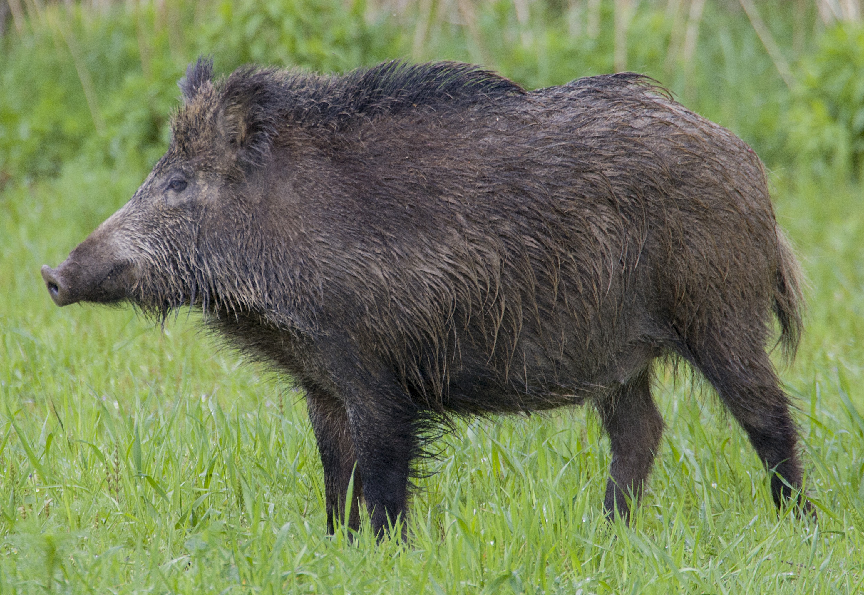
A spatial study in northern Greece mapped where suitable habitat for wild boar (Sus scrofa) overlaps with domestic pig farms, with the aim of identifying areas where wildlife–livestock contact could be especially relevant for African swine fever (ASF) surveillance. The researchers modelled wild boar habitat across about 38,000 km² in Macedonia and Thrace using hunting records from 2021–2023 together with land cover, climate and topography.
Suitable habitat was concentrated in forests, transitional woodland and shrub, natural grasslands, agricultural mosaics with natural vegetation and areas near water. Intensively cultivated plains and urban or peri-urban areas were generally less suitable. Elevation, rainfall patterns and colder winter temperatures were also associated with the modelled distribution, but these relationships describe where wild boar were recorded rather than direct causes of their presence.
Wild boar habitat overlapped with dense clusters of pig farms
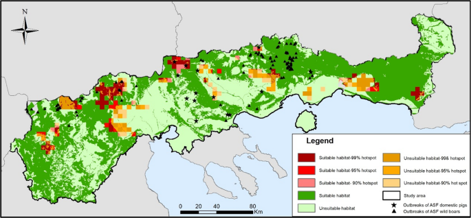
The researchers mapped spatial clusters among 665 domestic and commercial pig farms and overlaid them with the wild boar habitat map. Areas where suitable habitat coincided with the strongest farm clusters were classified as high priority for potential wildlife–livestock contact. Ninety-nine farms, or 14.9%, lay in these high-priority zones.
Outbreaks showed why the overlap map cannot stand alone
The recorded ASF outbreaks partly supported the spatial pattern but also showed its limits. Of 96 outbreaks in wild boar, 87 (90.6%) occurred inside areas predicted to be suitable habitat. Only four, however, fell in the high-priority overlap zones. Among 16 outbreaks in domestic pigs, eight occurred in low-priority zones.
This contrast is important because ASF can spread through routes that do not depend on direct proximity between wild boar and pig farms. The authors point to movements of infected animals or animal products and contaminated feed, water, equipment, vehicles, clothing and other material as possible human-mediated pathways. The map should therefore be read as a tool for prioritising surveillance and biosecurity where wildlife–livestock contact may be more likely, not as a prediction of where outbreaks will occur.
The authors also note that habitat suitability is not the same as wild boar density, that the static model does not capture seasonal movements, that hunting records can be influenced by hunter effort and accessibility, and that some small or semi-extensive pig holdings may be missing from official records.
Ecology
Related news
Maps Show Where Wild Boar Could Thrive and Spread on Jeju Island
Researchers mapped potentially suitable wild-boar habitat across roughly 36% of Jeju Island and identified eight possible corridors linking…
Read story →
Roe Deer and Wild Boar Remained Key Wolf Prey as Diet Shifted Across North-western Italy
From 2021 to 2025, wolves in north-western Italy continued to feed mainly on wild prey. In the Po…
Read story →
Copper levels in wild boar differed across Slovak districts
An analysis of kidney, liver and muscle from 147 wild boar in four districts found that iron and…
Read story →SPECIES IN THIS STORY
Species in this story
Independent research and conservation news archive
Did you find this information useful?
Wildlife Vagabond is independently built and maintained. Voluntary support helps cover source verification, hosting and continued work on research and conservation news.
Support Wildlife VagabondThe news archive will remain freely available.