
GPS Waypoints from Simulated Aerial Moose Surveys Were Displaced by Tens of Metres
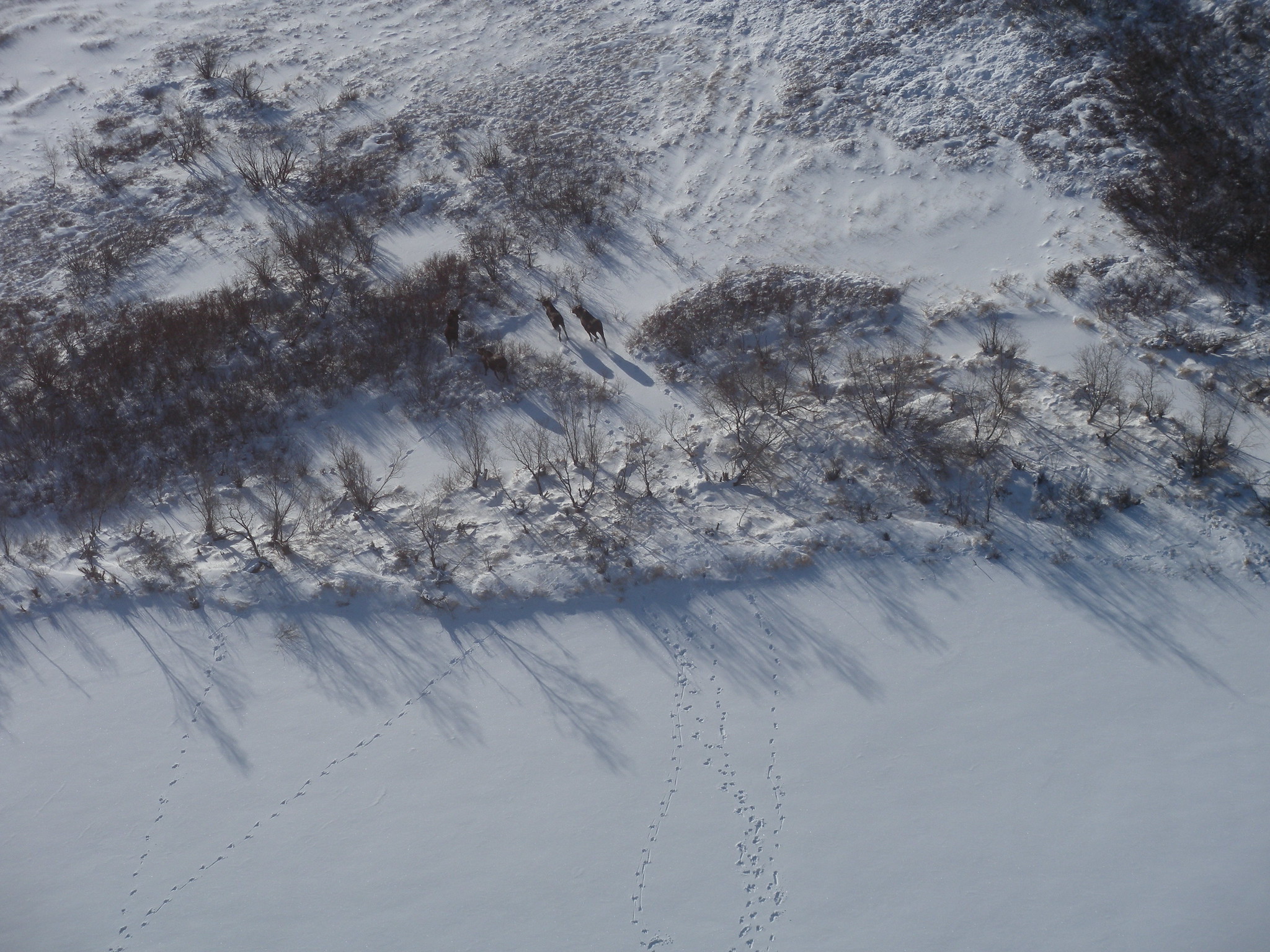
A point marked on a GPS receiver may look exact, but an aerial survey can place that point tens of metres away from the animal an observer intended to record. A case study from western Alaska, USA found systematic location errors in simulated moose (Alces alces) surveys conducted from both a fixed-wing aircraft and a helicopter. The errors were large enough to matter when observations were connected to fine-scale habitat maps.
The study, published in Alces on 19 February 2026, was designed around aerial monitoring of moose at the Yukon Delta National Wildlife Refuge. Researchers did not use live animals in the test. Instead, they selected a clearly visible fence gate near Bethel that was similar in size to a moose and established its location from 30 GPS readings collected on the ground.
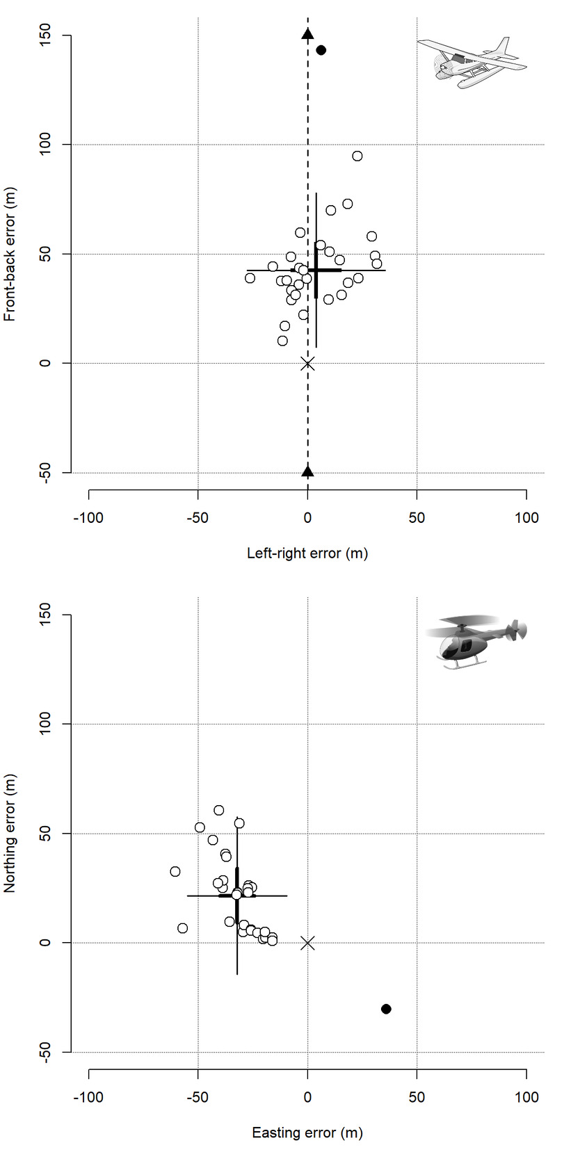
Fixed-wing waypoints were displaced by 46.4 metres on average
On 28 April 2022, a pilot and observer flew a Piper Super Cub over the target from different directions. The pilot tried to maintain an altitude of about 120 metres and a speed of 125 kilometres per hour. During each pass, the pilot counted down and called “mark” when the aircraft appeared to be directly above the gate. The observer then recorded a waypoint with a handheld Garmin GPS unit. The team collected 30 locations.
The following day, a helicopter team collected another 30 locations while hovering over the same target. These trials reflected a common field procedure in which a non-pilot observer marks the position of an animal seen during an aerial population survey. Because the true position of the gate was known, the researchers could separate error along different directions and compare the two aircraft types.
Fixed-wing locations were displaced by an average of 46.4 metres in the direction of travel. The authors considered a short delay between pressing the mark button and the receiver storing the waypoint to be a likely explanation. Perpendicular to the flight direction, the measurements did not show comparable systematic bias.
The helicopter results were shifted by an average of 20.1 metres north and 30.1 metres west. The researchers had not expected directional bias while hovering. They noted that strong easterly winds, averaging 27 kilometres per hour with gusts up to 40, may have pushed the helicopter after the observer initiated the waypoint.
Fine habitat maps magnified the problem
The practical issue was not only the distance between the recorded and true positions. Wildlife managers often place animal locations onto raster maps in which each cell represents vegetation, disturbance or another habitat feature. At a cell size of 30 metres, the estimated probability of putting a point into the wrong cell was 94 per cent along the fixed-wing aircraft’s direction of travel and 93 per cent along the helicopter’s east–west axis. Other directional estimates were also substantial.
Misclassification was lower on 90-metre grids, but it remained 45 per cent along the fixed-wing travel axis and 10–14 per cent in the two helicopter directions. At 250-metre resolution, the estimated probabilities were effectively zero in this experiment. The result shows why a position may be suitable for broad distribution mapping while being too imprecise for a fine-scale habitat analysis.
The measured errors are not universal correction values
The authors emphasize that the experiment was deliberately simple. It used one stationary target, one place, one day for each aircraft, one pilot-observer pair per platform and one set of weather conditions. A visible fence gate is also easier to mark than a moving or partly hidden moose. The measured errors therefore should not be treated as universal correction values for aerial surveys.
The researchers recommend matching required location accuracy to the spatial scale of the analysis, training and testing observers under realistic operating conditions, and applying analytical corrections when remaining error is too large.
Other research
Related news
Arctic Moose Follow the River Valleys
GPS tracking in Alaska showed that half of 24 female moose migrated between summer and winter ranges. Migrants…
Read story →
Thermal Drones Found Nearly All Moose in Favourable Winter Weather
Swedish trials found detection close to 100% in cold, overcast winter conditions, but the survey effort needed for…
Read story →
Even Adirondack Park’s Densest Moose Area Was Too Sparse for Precise Aerial Estimates
Helicopter surveys estimated about 92 moose in the Adirondack core in 2024 and 112 in 2025, but broad…
Read story →SPECIES IN THIS STORY
Species in this story
Independent research and conservation news archive
Did you find this information useful?
Wildlife Vagabond is independently built and maintained. Voluntary support helps cover source verification, hosting and continued work on research and conservation news.
Support Wildlife VagabondThe news archive will remain freely available.